Civil 3D 2021.1 introduced several new features including a new compass when creating a pipe run. This is excellent news, but depending on your modeling requirements, it can cause an issue if you leave in a new setting.
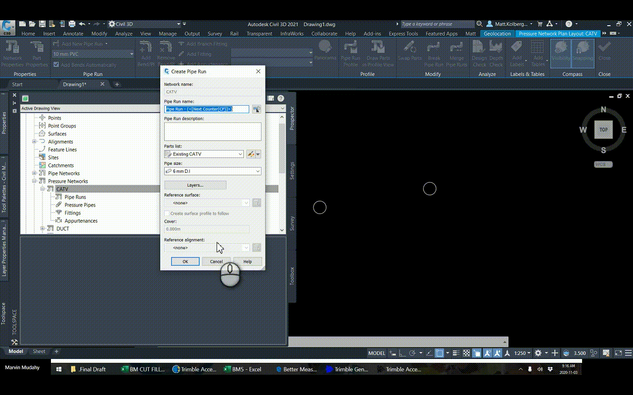
In the examples below, the parts list has no bends, and they are not needed for this design. The pipe runs as required to be drawn like a polyline. While working with a customer, I ran into this issue, but I could not find the solution, and surprisingly, neither could Autodesk. Thanks to my esteemed colleague, Colin Gaudet for discovering what turns out to be a very simple solution.
2021.0
This is the behavior from 2021.0 and it is the expected behavior.
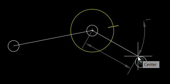
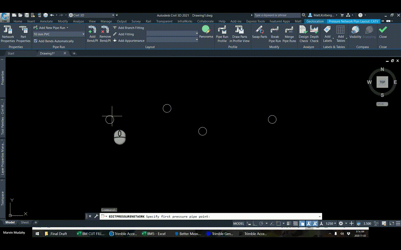
2021.1
This is the behavior after installing 2021.1. The compass indicates that there are no bends and it will not allow any angle to be drawn, only a straight line.
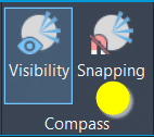
The Setting
There is a new setting to allow pipe runs to be “snapped” to known bend angles. Turn off the new setting to return to the expected behavior when there are no bends. The compass remains, but it now allows any angle to be drawn.
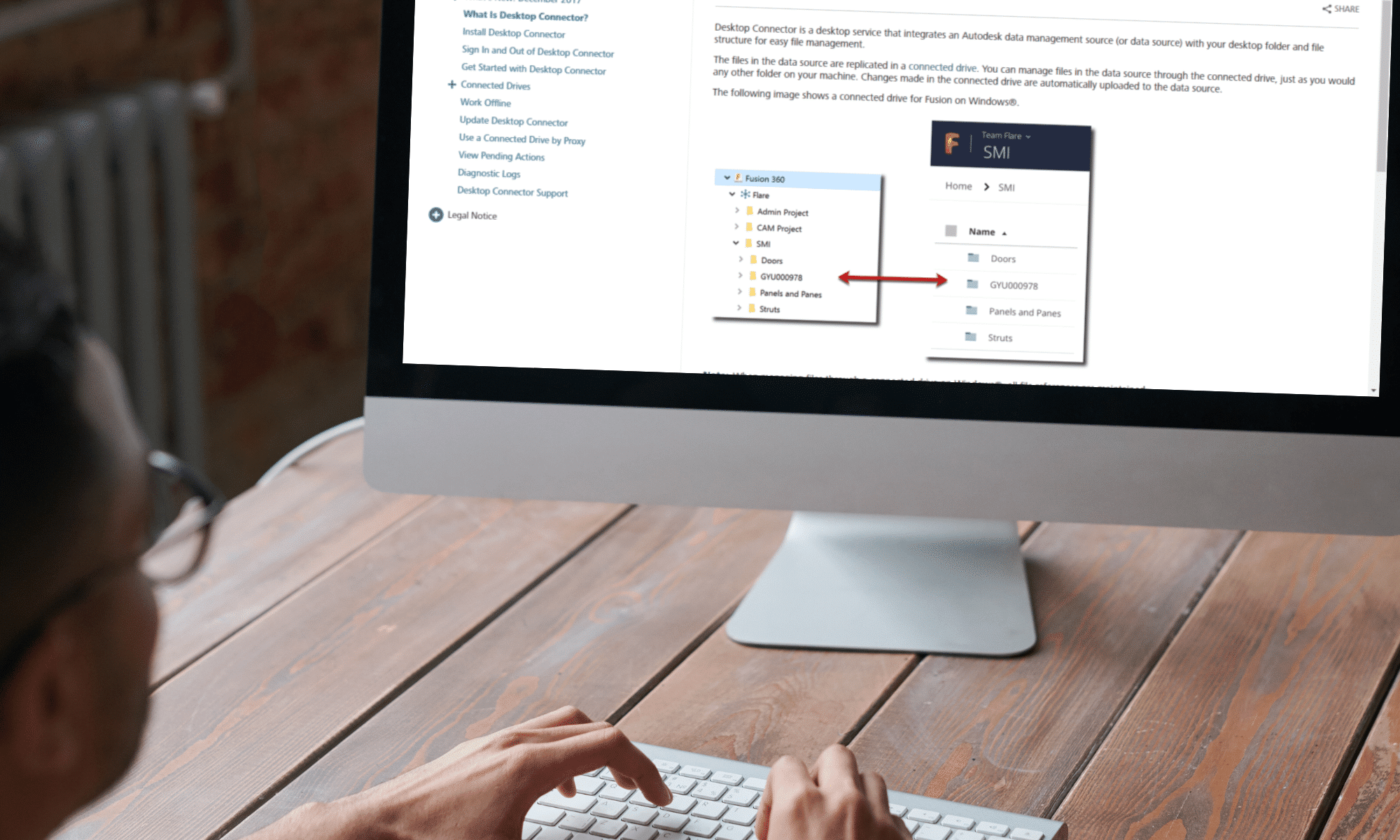
An update to the Desktop Connector as made available on August 11, 2020. Here is the relevant Autodesk document.
If you’re a Sheet Set user who also uses BIM 360, this update is for you. In addition to other resolved issues, the main feature in this update is that Sheet Set DST files are now recognized. When a DST file is uploaded via the Desktop Connector, any drawings contained therein and their references are all uploaded. When a DST is opened in AutoCAD, drawings will be synchronized locally.
Autodesk has released the first update for Civil 3D 2021. Find official documentation here. Here are some highlights:
Feature Lines:
Easily insert elevation points or PIs on feature lines at their crossings with other feature lines.
Set grade or slope between multiple feature lines. Use the previous new command to insert points first.
Pressure Networks:
Add/Move/Delete vertical bends from a pressure network.
Pipe run profile settings:
New overrides tab for specifying static or dynamic updates.
Profiles selection now includes a create from surface option.
You can now change a straight pipe to a curved pipe in profile view by grip editing, and change a curved pipe to a straight pipe.
BIM 360 Collaboration for Civil: Support has been added for reference templates and sheet set data files. You must install the latest update for the Desktop Connector.
ArcGIS:
You can add new objects that were created in Civil 3D to ArcGIS by moving them to an existing ArcGIS layer and then saving the layer back to ArcGIS. Changes to property set data are now saved back to ArcGIS along with the geometry.
Support has been added for exporting curves (instead of tessellated segments) to a file geodatabase.
Bridges
Support has been added for configuring layers for an existing bridge in a drawing.
Support has been added for assigning layers for bridge generic object subtypes.
Project Explorer: Autodesk Project Explorer for Civil 3D is an environment that allows you to review and analyze civil objects in the model. Here we will look at Alignments, Profiles, and Corridors. See this YouTube playlist. This is an extension which must be downloaded and installed separately from 2021.1.
Since my last post about the path of travel, Autodesk made a very useful update on the path of travel tool.
The path of travel was calculated automatically by Revit picking the start and end point. Now we have the ability to add waypoints along the path of travel. This allows us to drag the points and adjust the path. You can also delete the waypoints to restore to default position.
To activate the tool, simply select the path of travel. The tool will appear under the Modify| Path of Travel Lines. Select the Add Waypoint, click on the path of travel and drag it to adjust it. To delete it, select the Delete Waypoint and click on the point.
Plan production tools in Civil 3D are great for creating plan and profile sheets, but what about when the inevitable design changes come and you need to update your sheets? You either update them manually or recreate all new sheets. With CTC Software’s Sheet Generator, you can create plan and profile sheets that update after designs change, including refreshing of viewports, north arrows, matchlines, sheet names and numbers, sheet set data, and more. Sheet Generator provides better control on Profile Views, more flexible sheet management workflows, and easily dovetails with your company standards.
Autodesk has clearly spent considerable resources developing this update. There are many fixes and enhancements in this Vehicle Tracking 2018.1 update. You will find information about the update here. Click this link to view a recorded webinar. The update can be installed with the Desktop App or by downloading it from Autodesk Account.
There is one critical change that will affect all users. There has been a mid-cycle format change for the vehicle tracking objects. Don’t worry, the drawing format is not changing, just the vehicle tracking objects; roundabouts, swept paths etc. What this means is if a drawing is saved with 2018.1 and then opened in 2018 without the update, the vehicle tracking objects will appear as proxy objects and therefore not editable. All users’ workstations must be updated concurrently.
Since grip-editing is very popular method for editing vehicle tracking objects, it is recommended to install the Map 3D hotfix previously blogged.
A brief look at the changes:
Object format change.
Get units from the drawing.
Parking tool enhancements.
The majority of the enhancements are related to roundabouts and their corridors.

 The Setting